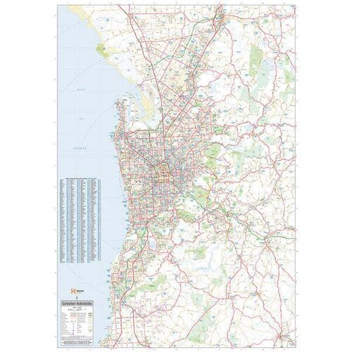
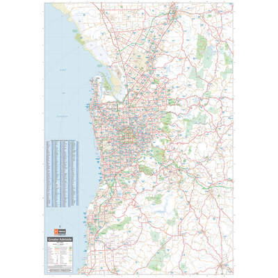


Description
Adelaide Supermap - 1000x1430 - Laminated (9th edition)
_x000D_
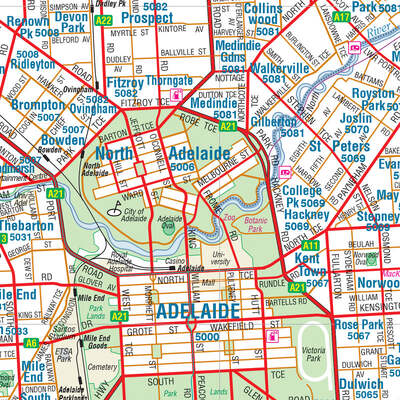
A large laminated map of the Greater Adelaide region that is ideal as a reference and for planning sales and delivery zones. Marked on the mapping are highways, major roads, local streets and suburbs in addition to 24-hour fuel, parks and caravan parks marked on the mapping. The map covers from Strathalbyn in the south-east to Gawler in the north.
_x000D_
_x000D_
Key Features
_x000D_
- _x000D_
- Very large map of Adelaide and the surrounding regions
- _x000D_
- Index to Suburbs, Towns and Localities with postcodes
- _x000D_
- Points of Interest and facilities listed (including fuel stops and accommodation)
- _x000D_
_x000D_
_x000D_
Key Specifications
_x000D_
Edition: 9th
_x000D_
Publication Date: 01/09/18
_x000D_
Scale: 1:80,000
_x000D_
Flat size (WxH): 1000mm x 1430mm
_x000D_
Weight: 0.45kgs
Specifications
| SKU | 9781865009643 |
|---|---|
| Barcode # | 9781865009643 |
| Brand | Hema Maps |
| Shipping Weight | 0.4500kg |
| Shipping Width | 1.430m |
| Shipping Height | 1.000m |
| Shipping Length | 0.004m |
SKU: 9781865009643

Adelaide Supermap - 1000x1430 - Laminated
Sale price
$139.95
Pay in 4 interest-free payments of $34.99

 More info
Make 4 payments of $34.99 over 8 weeks and get it now!
or interest free for up to 12 months with

Make 4 payments of $34.99 over 8 weeks and get it now!

Adelaide Supermap - 1000x1430 - Laminated - a large laminated map of the Greater Adelaide region that is ideal as a reference and for planning sales and delivery zones. Marked on the mapping are highways, major roads, local streets and suburbs in addition


.png)


